Saturday, 22 June 2013

Ghost of ages past

Birdsville pub

I was not the first of my family to order a beer at the Birdsville pub.  Not by a long shot.


In fact, before the first stone was ever laid to build either the pub or the town, my great great uncle, E A P Burt was out riding the red dunes in the area, scouting for a location to set up his store.


Ebenezer Alma Percival Burt, nicknamed Percy, was my great grandfather's brother. He was one of the founding settlers of the place that was to become Birdsville.


Percy owned and operated a large corrugated iron general store, called Burt & Co, opposite the Birdsville pub.


The street fronting the pub, and Percy's store, sat still bears his name:  Burt Street.


 Percy's store was on Burt Street, opposite the Birdsville pub

For a while, in no-name land, the crossing where he set up his shop was informally called 'Burtsville', possibly an easy address for the Afghan camel drivers to recall, as they began regularly delivering goods there, ordered for the run holders and workers of the Mulligan, the Georgina and the Diamantina.


Percy and others at the time, were responsible for the eventual location of the town, and its name.  They wrote to the South Australian government requesting that a township be located on the Diamantina Crossing for the purposes of servicing stations growing in the area.  As no answer was forthcoming from Adelaide the gentlemen eventually approached the Queensland government, who were happy to reserve several square miles for a town, on the Queensland side of the border in the early 1880s.


At the time customs were charged at interstate crossings, and Birdsville became a lucrative custom collection point until federation in 1901.   Albeit, that the first customs collector lived under the shade of coolibah tree after one of the legendary Birdsville sandstorms wrenched his calico tent from its pegs and sent it flying afar.  He sometimes held as much as '£2000 stacked around him' at any one time, as there was no bank yet in town.  Though he did carry a musket as protection for his wad.


Percy helped to organise the first Birdsville races which were attended by 150 local station owners, managers,  stockmen and townsfolk.  The meeting ran from the 20 - 22 September, 1882,  and the big race on the first day was the Burt Stakes, with a purse of 25 sovereigns.


After the prizes were handed out at Tucker's pub,  a meeting was held in Percy's large iron store where the first branch of the Birdsville Border Jockey Club was formed with forty-two keen members.   For many years Percy acted as either the Secretary, or the Treasurer, of the Birdsville Border Jockey Club helping to organise the races at Birdsville year after year.  He was often,  over the years, to present cups and purses at the Birdsville races.


At various times right through to Federation, Percy was appointed Chair of the Divisional Board of Diamantina and headed up committees which drew up the rules and regulations governing early Birdsville: operating very much like a Shire Council does today, organising everything from camel transit, to road maintenance, to rabbit proof fencing.


One of his best mates was William Blair, who built, owned and operated the Birdsville pub.   Percy married William's sister, Ada Susanne, one hot November day, in 1885.  Theirs was the first wedding held in Birdsville,  and was attended by a crowd of neighbouring squatters and managers who came to town especially to witness the event.  The couple honeymooned at one of the outstations along the Diamantina, Kyratunga, after which they returned to Birdsville to continue their work in town.


Percy was at the Birdsville pub just a couple of months later, when William and Ada's brother,  Edward,  rode into town after a long hot day in the saddle.  Edward proceeded to drink pitcher after pitcher of water,  trying to quench a raging thirst, but within hours complained of severe stomach cramps.  Which did not ease.  Edward died a painful death that very night.


The land around Birdsville

Another of Percy's mates was Robert Frew, who owned one of the other stores in Birdsville.  Robert was known for being in John MacDouall Stuart's exploration party to the northern gulf from Adelaide  in 1862.  He became one of the first settlers in the Birdsville region, setting up Haddon Downs, Cadelga station, and helping to form Pandie Pandie.  Percy was with his friend Robert Frew the night Robert drank himself to death at the Birdsville pub.


The times were hard.  The living was tough.  The tough did always survive.


Life was made harder for Percy when Queensland opened a railway link to Barcaldine allowing many of his customers to trade directly with Rockhampton or Townsville stores.  His income dropped from £14,000 pa. to barely £5,000 pa. in just one year.


So, when storekeeping was no longer a viable option, Percy sold up in Birdsville, and headed further west, to mine in the West Australian goldfields.


Survival kit, Birdsville museum

Where life was to become even tougher.


And, propping up the Birdsville bar with many an old mate ready to discuss the pros and cons of the next to last race -- became barely a memory.


oooOOOooo

Gibber, grass and gas fields

Just a few decades ago,  Innamincka was virtually a ghost town: its pastoral history its only real story.  

Back then, after the Burke and Wills exploration, early pastoralists moved their cattle up from the more populated southern states, and Innamincka and Coongie  became vast cattle fattening and horse breeding stations, all bought, at the turn of the new century, by Sidney Kidman -- nearly 14,000 square miles of gibber and grass with access to the occasional water that flows south into the shallow inland creek beds.


Flat land and fattening cattle


The cattle station traffic encouraged the development of the small township of Innamincka, with a hotel, a store, a saddler's shop, a Chinese eatery and a police station.  Nurses set up an Inland Mission to look after the medical needs of the widespread community, but, over time, that all came to a standstill,  and it was only began to be revived after oil and gas were discovered in the surrounding Cooper basin after the 1960s.


Today, thanks to the hydrocarbons being pulled from the ground around here, Inamincka is, again, thriving.  The Inland Mission building has been renovated and now acts as a tourist information centre.  The hotel, while lacking the bush character of Nockundra,  has expanded, and is as well run as most in any city.  Today it offers anything from excellent coffee, to historic river cruises, to mining conference facilities and accommodation.  The shop next door is well stocked; the comunity growing.  A constant flow of traffic from mining personnel and tourists keeps the town square busy, even vibrant.


Well managed hotel at Innamincka
Once, only camels and bullocks could negotiate tracks this far inland.  Today, the well graded gravel roads cope with a trail of dust-raising mining utes, road trains, camping rigs and delivery trucks.

One delivery driver we spoke with brought with him just one package from Orange, in less than twelve hours from pickup.  He still had another hundred kilometres to go before dark, his direction for delivery reading simply: "a hundred clicks north of Innaminca".   We chatted to  him late in the afternoon as he was taking time out to reserve a room for the night at the back of the pub in case he might arrive back from delivery well  after pub closing time.  And, to find out from the store, what lay a hundred clicks north of Innamincka; and what condition the road might be in for the rest of his trip.


A little bit of outback station ebay, perhaps.  Or a piece of mining paraphenalia ordered.


Hard to imagine, though, the eventual cost of that dedicated delivery charge: including diesel, accommodation, vehicle maintenance, extended hours of a driver's time.


All for one package.


Solar powered hot water in the amenities opposite the pub

We were advised by locals and transit visitors not to take the near road that headed north.  The January floods had caused deep washouts;  the land abrasians were reportedly too difficult to negotiate.  The delivery truck was planning to risk it.   But not us.  We took the local's advice and travelled the much longer route to Birdsville via the Arrabury Station track, a little over 500 kilometres that day.


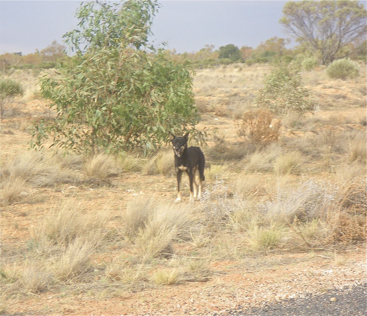
Wild dog along the Arrabury road


Which was all wide open road, lonely wild dogs, and the occasional things that go bump on the landscape: all oddly and uniquely beautiful.


Traffic jam - turning west to Birdsville

Further along the Birdsville Developmental Road we passed the most beautiful work of stone art: a sinuous Rainbow Serpent has been woven around one of the dune forms enroute to Birdsville.   It is quite stunning, but with no explanatory board anywhere we have no clue as to who did it, why, or for what reason.  But it made a beautiful photo opportunity: all pink and white and blue, and so real it was almost moving.

Rainbow serpent sliding around the sand dune


We arrived to more stunning colour at the Birdsville Bakery, where the delectable curried camel pies are on offer; and where the astonishing Sturt's Desert Pea has been planted, and is in full rich colour.


The colour of blood.


Sturt Pea at Birdsville Bakery
And some Koori tribes tell a tale of blood.  Of a young woman who escaped wedlock to an elderly man by running away with her young lover.  But the lovers were tracked down.  The jilted man killed them both, and their relatives.   But, later, when he returned to their place of death he found blood-red flowers growing out of the dirt where their blood flowed.


Into the setting sun enroute to Birdsville

As the sun goes down and the seething mass of retreating flies gives us a little respite for the evening, we head across the road to hang our hat, along with others there,  at the iconic Birdsville pub.


Hats on display at Birdsville pub


This is as far west as our convoy of travellers is headed this trip.  Birdsville.  

Saturday, 15 June 2013

Under the shade of the Coolibah tree

The flatter it gets, the drier it looks, the less it seems likely that life can be sustained out here.

Yet beneath the wheels of our vehicles lies one of the largest water basins on the planet: the Great Artesian Basin.  Which behaves much like a giant sponge, soaking up water over the millennia, collecting it in impermeable underground holes and tunnels, caves and niches.  

Two hundred million years ago this great flat dry land was covered in water.  In parts of this basin you can still dig up sea fossils from that time.  Back then the northern part of Australia tipped towards the sea.  Not just once, but three times.   Sea water flooded in, filling up these giant inland water bowls.   Rain water funnelled underground from natural 'drain pipes' high in the eastern and northern mountain ranges; the  'piped' water behaved the way water typically behaves: gradually being pulled down and down by gravity until it finds the lowest point:  a barrier, where its progress is stopped, where it is collected.   It is as if there is a massive water tank deep beneath this sun-parched land, where gibbers and pebbles sometimes appear as the only surface vegetation.       


The dry crossing between Queensland and South Australia

Aboriginals, with their affinity for the land, were able to suss out water even when it had not rained for months, even years.  White man was not so lucky.  Out here, tales of torturous deaths from lack of water, lack of nutrients, are commonplace, still.

Yet, some men survived, even flourished.

Before he was even twenty-one, barely ten years after Burke and Wills disastrous and deadly trek through the very heart of Australia,  John Conrick and his mates drove a thousand head of cattle from Warrnambool in Victoria, to settle on a holding near here, called Nappa Merrie.   Conrick was a youngster, an overlander, a drover -- yet he rapidly learned bush skills that enabled him, his men, and  his holdings, to thrive.


Nappa Merrie station entrance

While it looks as if it grows nothing but dust, Nappa Merrie, leased today by Kidman & Co from Santos,  runs anything up to 15,000 head of cattle on its vast stretches.  We hardly saw any cattle, but the land goes forever: they were there.  Great bores, supplementing the unreliable water that occasionally flows down channels and creek beds, have been sunk deep, searching out artesian water for the cattle.  Sometimes they bore down 500 metres, sometimes 2,000 metres have to be drilled before water is reached.

Not far from the Nappa Merrie sign, along one of the worst gibber and corrugated roads we have travelled, still inside the station boundary, lies the iconic Dig Tree of Burke and Wills fame.   Growing on the banks of the Bulla Bulla waterhole on Cooper Creek, stands the Coolibah tree, the eucalyptus microtheca, that bears the remnant scars of DIG scored into its bark.    This tree lies at the very heart of Burke and Will's Camp 65 made here in December, 1860.   In his rush to push north, Robert O'Hara Burke left his remaining team of men, camels and supplies, here, with orders to Brahe and his men to wait for them for the three months they expected to be gone.  They took supplies just to cover the three months.

Brahe waited four months.  Thinking that Burke and Wills must have taken a boat from the northern shores and shipped back to Victoria instead of returning overland, Brahe, with a paralysed man in his charge, decided to leave Camp 65 at 10.30am on the morning of 21 April, 1861.

He left a note, and what provisions he could spare, on the remote chance that Burke and Wills might return this way, planting them under a Coolibah tree, cutting a blaze in the bark of the tree on the land side, exhorting any searchers to DIG.


Old shot of the Dig Tree as it once was

Barely nine hours later,  at 7.30pm that night, Burke, Wills and King, hobbled into Camp 65.

They had just lost one of their team of four to the paralysis that had struck Brahe's party.  Nutritional deficiency. Taking a day to bury him meant they missed Brahe.  They had eked out their supplies over the four months, supplementing them with portulacae, trying to combat scurvy, but they were all weak, and in need of assistance.

They found the DIG tree at Camp 65.   They uncovered the cache of supplies.  But it was only when he read Brahe's note that Burke began to lose hope.

Brahe left a message saying they were heading back to the Menindee camp that day.  He then reported that he and his men were in good condition.  This news clanged like a death knell to Burke.  He knew that neither he, Wills, nor King, had a hope of catching any party in good condition.   And that nine hours advance by Brahe, was much too much to make up, given their weakened condition.  

Days later,  the trio set off stumbling in the opposite direction, with their noses pointing towards Mount Hopeless, in the hope they might make it to help before collapsing.  That was not to be.   Other trees now mark the spots where Burke and Wills died along the Cooper.  Only King survived -- but not even he for very long.  He lived to marry, but died soon after: made fragile from the harsh trek.


Where Robert O'Hara Burke lay dying

This tragic tale lies at the very heart of the early history of this harsh and uncompromising country.

Yet Cooper Creek appears at peace.  Corellas nest in the coolibahs.  And gather in their thousands, screeching and swooping at dusk, until they find a roost for the night in the silver grey gums beside the still blue waterholes.


Nesting corellas awaiting the influx at dusk

Other blazes mark other coolibahs along the Cooper.   Many scars have been made by early aboriginal tribes who wandered here, curling off outer bark with their stone axes and chisels, to make coolamon bowls.  In these bowls they could mix ground coolibah seeds, shaping them into cakes with the flavour of eucalyptus.  Soothing.  Or prepare fish, which they caught in nets made from the lignum plant on the creek bank, soaking and pounding and weaving it into nets that they strung across the creek on reeds, catching fish after plentiful fish.

Or to leach nardoo.  The fateful nardoo.

Had Burke and Wills been more inclined to take note of the aboriginal ways they might have observed that before they used any seeds they harvested from the nardoo plant at the water's edge, that aboriginals soaked the toxins from the nardoo before drying and pounding and shaping the flour into edible cakes.


Nardoo: so green, so lush, so deadly

A simple lessons that might have saved lives.

We camped at Innamincka on the Town Common on the Cooper, one of the most beautiful campsites in Australia.


We were just a short distance from the trees which mark the last resting places where Burke and his trusty colleague, Wills, lay to breathe their last: Wills with his diary in his hands, Burke with his gun, and  his friend and fellow explorer,  King, close until the end.

It seems incongruous that this river of plenty and peace has been witness to such a futile tragedy.


Monday, 10 June 2013

Bees, brolgas and beer


Turn left at the Bowra post box 

We stop at Bowra where daytime birdwatching and evening birdcounts are on the agenda, but this time our  grey falcon flew elsewhere.     


Galahs in the gum


Bowra is now owned by the Australian Wildlife Conservancy who, with the help of volunteers, keep this unique and protected property open for birdwatchers.  It is a patchwork of ecosystems encouraging great diversity in bird habitats,  and one of these was our water viewing spot under the red gums beside Gumholes Creek.


Gumholes observatory

We camped near the old shearing shed, still kitted out in its original shearing gear, with wooden floors rich with wool oil,  that most home owners would die for.   Some thoughtful volunteer has built a temporary shower amidst the industrial relics, using wood studs tacked with tarpaulins for walls, and gallons of hot steamy water on tap at the end of a dusty day.


Once upon a shearing shed

The road is narrow, the land flat, the sky huge as we head west in the morning.  


Narrow paved road with literally no traffic

We call in for some date wine at the Eulo Date farm and admire the shop decor: a long line of old cowbells and lanterns.


Rustica bush artifacts at Eulo Date farm store

Outside, there is a shed, built partly of kerosene tins, its interior lined with ancient  'stuff' to attract the passersby.


Shed trivia

Not to mention the artesian mud baths, Aussie-style, available in colourful open air tubs in outdoor surroundings for those who have an hour or two to luxuriate.  A spa with date wine: what more could one want.


The gritty artesian water runs out of a tap in the tree trunk

They also sell the local and unique Yapunyah flavoured honey.


Rare and local honey

This honey is gathered by bees who have been happily sipping at the blossoms of the rare Eucalyptus ochrophloia which grow on the banks of the Warrego and Paroo rivers, just out of town.  Beekeepers from all over Australia regularly bring their bees here in flower season, and the honey is collected by spinning the liquid from the combs using a centrifuge, letting the wax settle on top overnight, then tapping the liquid gold, from the bottom of the vat, into containers for sale.


From the blossom to the bee


We cannot always find picnic spots for morning tea or lunch, so then shade becomes our priority, and as soon as that is found out come the collapsible chairs, tables and picnic packs filled with goodies.  


Bush cafe


And we eat as we recount the emus, dingos or brolgas that we have come across so far enroute.


Beautiful balletic brolgas
Glossy coated dingo calmly scouting the flat plains 


Thargomindah was the start of the flies.  Someone, somewhere, told us that the incessant flies we were to battle with for well over a week from hereonin, were around because there had been rain.  The rain grew the blossoms.  The blossoms attracted the flies.  

It didn't take us long to figure that there must have much rain.  

Tho', a couple of our convoy had yet to find their fly nets as we snapped them, looking like locals, on the slatted bench outside the supermarket. 

No need yet for flynets attached to the hats
The lands is becoming flatter, and while we rarely see evidence of them, somewhere, tucked away in these flat plains there are cattle:  this is beef country. Squatters, of the eighteen hundreds, who missed out on the more fertile parts of Australia had no hesitation taking up selections in these parts when parcels of land were there for the taking: the Dowlings, the Leahys, the  Duracks, the Costellos have all left their mark on longitudes west of here.  

This lovely traditional mud brick house, once owned by the Leahys of Thargomindah, was later purchased by Sidney Kidman.  


Leahy house beautifully suited to the Thargomindah climate 


The road to Nockatunga is better than most roads anywhere in Queensland.  Three cars could fit, at speed, on the bitumen.  This is new.  

This is a direct result of the mining going on in these parts.


Three lanes wide now, yet still there is no traffic

Like the cattle, the mining is tucked well away.  Only now and again can you see the occasional derrick or mining rig.  But the influence here is vast and the amazing road surface, right to the South Australian border, is testament to that.  

Underneath Australia's gravel lies enormous wealth.  

First there was beef: then came oil and gas.  


We have been lucky with our evening campsites: which, to date, have all been by water.  Tonight is no exception: this free and glorious waterhole is on the Wilson river just opposite the historic Noccundra pub.  Some of us throw in our yabby pots hoping for an entree, while others write up the events of the day while they are still fresh.  


Noccundra waterhole


As the sun sinks low we head across to the Noccundra pub.   Long ago this was part of the Nockatunga station.  The talk, then, would have been sheep and weather and wool prices.   Nowadays, the  locals who prop up the bar are miners who speak of mines and markets and money.    Their airstrip is out to one side.  Since 1882, the pub has been the only building in town,  but it is going nowhere.  


They tell us that there are three thousand miners in this dry dusty mineral basin right now.   A lot of liquid is needed to quench that big a thirst.   


Historic stone Noccundra pub


Tuesday, 4 June 2013

Water and woes


 Fancy that hat

As you drive further west in Queensland the hats become more distinctive, as do the post boxes.


Big post boxes, to match the stations


The land is becoming dryer: water precious.  This is brought home to us when we stop at the Weengallon rock wells, enroute to St George.  Here a collection of ancient aboriginal water wells, laboriously pounded by hand into the hard dry earth, descend for about twelve feet.  

 Dug deep for the cool and the cache


In the days before European settlement uprooted their world, the Kalkadoons -- travelling to trade from their  homelands in the Mt Isa region towards the Boobera Lagoon region: Goondiwindi -- needed to ensure a permanent water supply for their tribes folk.  Rock wells, like these, came to dot Australia's hinterland. They were made to last.  Some have walls lined with hard timbers. Some are decorated with carvings.  Some have hand dug channels which funnel rainwater into them over time.  Some are covered by rocks, twigs or leaves to keep the water fresh, and to keep the animals out.  Today, the Weengallon wells are maintained by the traditional owners of this land, the Gomeroi people, in honour of those long past who depended on them for survival.  

We headed further west, but just missed the free beer at the Nindigully pub, set back from the banks of the Moonie River.  

Free beer always on tap at Nindigully

We were, however,  in plenty of time for a schooner and a pub lunch; served by the ubiquitous European backpackers, who seem ever cheerful and ever willing to work in these rural and more characterful parts of Australia.

Iconic Nindigully


The 'Gully' as it is called, as with many old buildings in this dry climate, has some of its original bits still standing in their original location: making it one of the more historic pubs in Queensland.   Built of rough sawn timbers back in 1864, it was first used as shearer's quarters for Nindigully Station until, as inland traffic expanded, it soon became converted into a Cobb and Co staging post, ideal for the routes becoming well trodden, heading to the north and the west.

Beer and a yarn at Nindigully

At its most populous, a century ago, the township of Nindigully consisted of not much more than the pub, a house, and a general store: more than survives today.  Prickly pear may have contributed to its demise.  Back then, selectors and graziers on surrounding stations, were pluckily attacking the cursed pear, but to no avail.   Emus,  sometimes sitting on as many as fourteen eggs at a time, were broadcasting the pear faster than it could be cleared.  Apart from being emblems of Australia, emus were partially protected by an Act of Parliament.   Such was the state of affairs that it led one wry observer at the time to note that sheep farmers would be well advised to retire from their stations - and to take up poultry farming instead.   


Emus spread the prickly pear 

The prickly pear exterminator,  the cactoblastus moth, was still a decade away from being introduced as the solution.  A little too late for townships like Nindigully.  

We camped overnight on the banks of the Balonne at St George.  Water is writ large in the history of this town.  On St George's day, in 1846, Surveyor General Major Thomas Mitchell, crossed the river at a narrow bridge of rocks, naming the site: St George.  We saw the remnants of this rock bridge on our Sandybank river cruise at twilight.

Balonne in the twilight

As the town expanded, demand for water grew, so an underground bore was drilled in 1904.  At that time the bore happily spouted out about 600,000 litres a day from its artesian depths.  Today, dwindling water from that ancient source has to be pumped up.  The days of endless free underground water for the township of St George are limited.   

To harness the flood waters that sporadically ravage town, the Beardmore dam and the Jack Taylor Weir have recently been constructed.  Great for irrigation of the new cash crop, cotton, in the good times. 

Floods rise right up to the houses


And fine when all the rivers run.  

A little sad on our visit, though, as downstream, it is all high and dry. The southern side of the weir is barely potholed with shallow water pools.  This is not helped by the idiotic scenario where water, committed further downstream, is released too soon by the remote authorities, who have failed to contact the receiver to see if he is ready to harness the oncoming surge.  Consequently, precious water released simply washes downstream, wasted.   And has to be released again.  And again.  

Woe, St George.  

Shades of Nindigully.